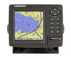
Product Description:
Features:
5.0" (12.7cm) diagonal 16-bit color SolarMax TFT display
High-detail 480V x 480H pixel resolution
Wide viewing angles in all light conditions
Fluorescent cold-cathode screen and keypad backlighting
Precision internal 12-parallel channel GPS+WAAS antenna
Expanded, built-in enhanced background map of the continental U.S, and Hawaii with over 3,000 lakes with depth contours
Compatible with optional plug-&-play Lowrance FreedomMaps, Fishing Hot Spots Elite, LakeMaster Pro Maps, NauticPath USA, and Navionics electronic charts
One-touch MOB (Man Overboard)
1,000 waypoints/1,000 event markers/100 routes
100 savable plot trails/10,000 points per trail
42 different graphic icons to mark your favorite spots
40 map zoom ranges, 0.024,000 miles
NMEA 2000 compatible for LowranceNET networking
5-pin Ethernet expansion port compatible for radar, video and satellite radio
One full RS-232 port for NMEA 0183 data communications
One waterproof slot for digital media card (MMC/SD not included) to record GPS details and display optional custom mapping
Back-up memory saves customized settings
Enhanced data processing
Fast screen updates
Sealed and waterproof
Full one-year manufacturers warranty
Includes:
Lowrance GlobalMap 5300c
Protective front cover
Mounting bracket
Power cable
Base map
Manual
Shipping Weight: 4.0 pounds
Any quantities are available. Email me if the quantity you want is not listed or you would like a larger order.